Corpusfishing.com Forum Index Corpusfishing.com
Fishing Reports and information for the Coastal Bend
 

HOME | SITE INDEX | WEATHER | LINKS | TIDES | BUY FISHING BOOKS | BOB HALL CAM | SFCCI| GUIDES                             
 FAQFAQ   SearchSearch   MemberlistMemberlist   UsergroupsUsergroups   RegisterRegister 
 ProfileProfile   Log in to check your private messagesLog in to check your private messages   Log inLog in 

packery ?

 
Post new topic   Reply to topic    Corpusfishing.com Forum Index -> General Saltwater Fishing Forum
View previous topic :: View next topic  
Author Message
dlehmann


Joined: 11 Jun 2010
Posts: 8

PostPosted: Thu Jul 15, 2010 8:54 am    Post subject: packery ? Reply with quote

new and haven't seen..is packery what divides mustang and padre? or something else
Back to top
View user's profile Send private message
Rebecca of Sunnybrookfarm
Full Grown Flour Bluffian


Joined: 01 May 2008
Posts: 3974

PostPosted: Thu Jul 15, 2010 9:19 am    Post subject: Reply with quote

yup, check it out on Googleearth.
_________________
Central Scrutinizer wrote:
Thanks for the Memories, Ranger Rick.


ziacatcher wrote:
However I bet if you were fishing naked Ranger Rick would have a problem with that
Back to top
View user's profile Send private message
Uncle D
Full Grown Flour Bluffian


Joined: 14 Mar 2006
Posts: 1645
Location: Third Coast

PostPosted: Fri Jul 16, 2010 9:19 am    Post subject: Reply with quote

Go check it out some time. All you need is a parking permit (if you park). The easiest access is Zohn rd.
Back to top
View user's profile Send private message Send e-mail
Willee
Horse Mullet


Joined: 24 Aug 2007
Posts: 223
Location: Corpus Christi, Texas

PostPosted: Sun Jul 18, 2010 9:21 am    Post subject: Reply with quote

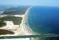
No ... the Packery Channel is still on Mustang Island.

Padre Island dont start until somewhere south of Bob Hall Pier.
Check the map for the marker number.

Willee
_________________
Willee 361-563-1303
Back to top
View user's profile Send private message Visit poster's website
Big John
Full Grown Flour Bluffian


Joined: 07 Mar 2006
Posts: 2647

PostPosted: Sun Jul 18, 2010 9:43 am    Post subject: Reply with quote

Mustang Island actually runs from the southern park boundary of Mustang Island State Park, at Fish Pass northward. North Padre is everything else south of Fish pass, through the park boundary for PINS. Padre Island is everything south pf there to the Mansfield Jetty. However the whole thing is often refered to as Padre Island.

http://en.wikipedia.org/wiki/Mustang_Island
http://en.wikipedia.org/wiki/North_Padre_Island
http://en.wikipedia.org/wiki/Padre_Island

Here is a great map that shows roads and most geological features like pass names, then names of holes, depth readings, landmarks, etc..

http://www.stxmaps.com/map/Default.cfm

Here is a great site for info about Padre ISland and most other Texas things: http://www.tshaonline.org/handbook/online/articles/PP/rrp1.html


Back to top
View user's profile Send private message
Display posts from previous:   
Post new topic   Reply to topic    Corpusfishing.com Forum Index -> General Saltwater Fishing Forum All times are GMT - 6 Hours
Page 1 of 1

 
Jump to:  
You cannot post new topics in this forum
You cannot reply to topics in this forum
You cannot edit your posts in this forum
You cannot delete your posts in this forum
You cannot vote in polls in this forum


Powered by phpBB © 2001, 2005 phpBB Group